Download Center
Opinion Research
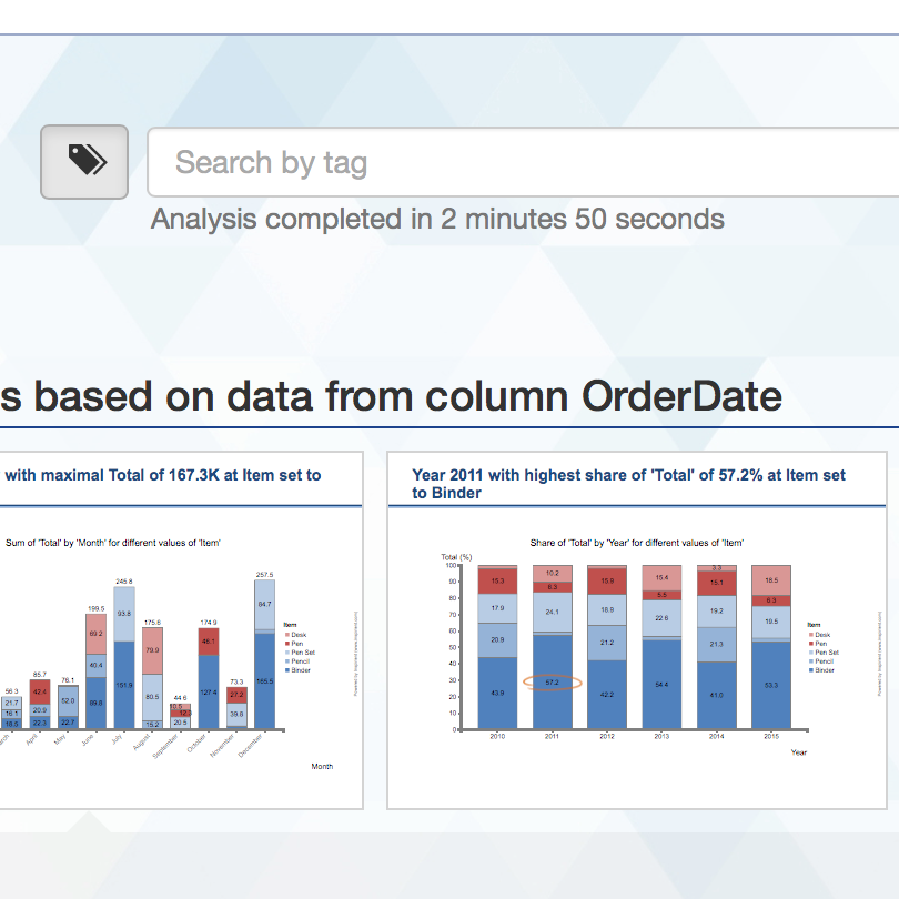
Results specific to the field of public opinion polls
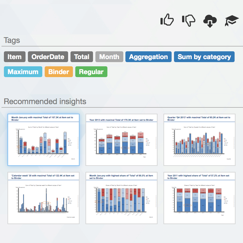
Contingency Tables
Contingency tables (or cross tabulations) display the frequency distributions of a dataset's variables
 Contingency tables - Zones limit_es _ 30 km-h - TOPOS 2016 - Orl_ans M_tropole (15 Jan 2022).xlsx
 Contingency tables - Zones limit_es _ 30 km-h - TOPOS 2016 - Orl_ans M_tropole (15 Jan 2022).zip
Miscellaneous
Other downloads resulting from this analysis
Enriched Input Data
 Enriched input data - 817c79f2-351e-4985-9b6c-107403257b9f (15 Jan 2022).csv.zip
 Enriched input data - 817c79f2-351e-4985-9b6c-107403257b9f (15 Jan 2022).json.zip
| Name | Type | Slides | Date | Remove |
|---|
— none —